Why does New Zealand keep disappearing from world maps?
Has anyone ever asked you whether New Zealand is part of Australia — or where exactly it sits on the world map?
From the famous Universal Studios globe in Florida to a 2019 IKEA wall map, New Zealand has been cropping up as a glaring omission. But why does it keep happening, and what does it reveal about the way we read maps?
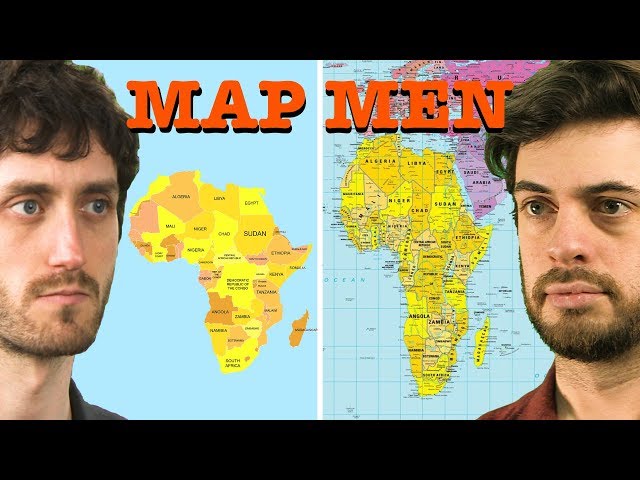
These are the sorts of cartographic puzzles that British comedians and geography enthusiasts Mark Cooper-Jones and Jay Foreman — better known as Map Men — delve into in their book This Way Up: When Maps Go Wrong (and Why It Matters).
After years of producing punchy YouTube episodes about oddities in geography, the pair realised they needed more space to unpick the stranger corners of cartographic history: vanished Soviet cities, phantom borders, "paper towns", and the idea that smartphone maps might be eroding our ability to navigate.
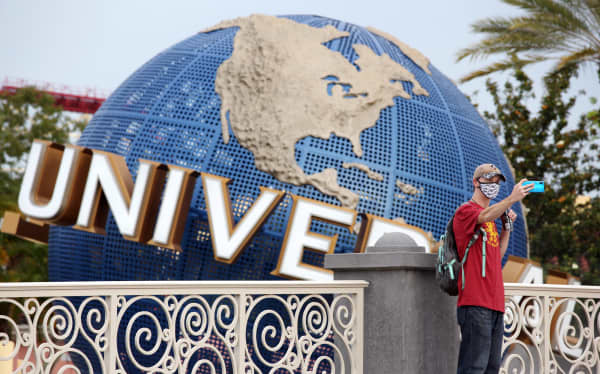
A visitor takes a selfie at Universal Studios theme park on its reopening day during the coronavirus pandemic, on 5 June, 2020, in Orlando, Florida.
AFP / Gregg Newton
Vanishing countries and areas
Foreman tells Nine to Noon part of the problem of New Zealand's absence from maps is simply recognition.
"If you actually start typing the words 'Is New Zealand … ' into Google, Google will then helpfully suggest the rest of the sentence for the thing that's typed most often: 'Is New Zealand part of Australia?'"
Geography plays a role too. New Zealand's position on the far corner means it's often cropped out, he says. Sometimes the explanation is even more mundane: Universal Studios' globe didn't include it because "they didn't have a slab of metal small enough".
Yet New Zealanders tend to take the slight with good humour. Cooper-Jones points out that even a New Zealand government 404 error page once displayed a world map missing the country entirely, with a cheeky message: "We’re sorry, something’s missing…"
But Aotearoa isn't the only habitual victim of careless cartography.
"There is a rule that if you spot a map where New Zealand is missing nine times out of 10 something else is going to be missing as well."
Novaya Zemlya, a large Arctic archipelago at the top of Russia, and Antarctica are often left off as well, he says.
How accurate are maps?
The Map Men argue that we trust maps far more than we should. As well as human biases, there are also certain projections don't accurately reflect relative proportions of countries or continents.
"The Mercator projection, which is what Google Maps uses in its projection, quite famously stretches the poles and makes the middle bits around the equator look a little bit smaller," Cooper-Jones says.
Even in an age of satellites, maps are shaped by human choices, Foreman says. Borders, coastlines, even place names involve judgment, interpretation or, sometimes, selective editing.
"I think in 2025 a lot of us think that we're quite literate at deconstructing biases, whether it be in like we know that statistics can lie, we know that different media outlets will have political biases and all that kind of thing," Cooper-Jones says.
"But for some reason when we look at a map we just think it's telling us the truth … that makes them, in a way, sort of quite dangerous, because people can manipulate that and use them to their own ends."
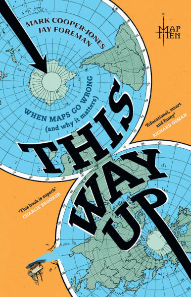
This Way Up: When Maps Go Wrong (and Why It Matters), by Mark Cooper-Jones and Jay Foreman.
Supplied / Harper Collins
During the Cold War, the Soviet Union embarked on what Cooper-Jones calls "one of the biggest, most organised, largest scale, most bureaucratically involved, intentional incorrect mapping exercises".
"Actually on both sides [of the conflict] really, map censorship was a very important part of … protecting that really sensitive data, particularly the military sites and things like that.
"But the Soviets just took it to new extremes. So, they were deleting entire towns and cities off maps … and they even went further than censorship, they started to just put wrong things on their maps to essentially just confuse the enemy - should it fall into the hands of foreign spies."
But ironically, the Americans already had satellite technology so it was pretty much a futile exercise, he says.
Why are there places that don’t exist on maps?
Just as places disappear from maps, others have appeared without ever existing.
The Mountains of Kong — a fictional mountain range — occupied maps of West Africa for a century. The cartographer who drew a "absurd single file, very, very, very long mountain range" had relied on a fleeting note from the Scottish explorer Mungo Park, who had observed mountains in the distance.
The fictional range also influenced how the Europeans travelled there and "were carving up Africa for themselves", Foreman says.
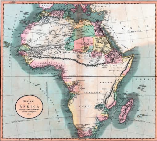
The ‘Mountains of Kong’ on John Cary’s map of Africa (1805).
Supplied / Mark Cooper-Jones and Jay Foreman, Harper Collins
Other phantom places were inserted on purpose. The township of Agloe, New York, began as a "paper town” — a fake location added by mapmakers to catch copyright infringers. But thanks to that map, it became real.
A couple building a shop in the Catskills consulted a map to find out where they were, saw Agloe, and named their new store the Agloe General Store.
"By naming it the Agloe General Store, they turned Agloe, which was a paper town, into a real town."
To Cooper-Jones and Foreman, the worst maps are in fact the best. They're not only funny but also reveal something about people, politics and perspective.